Personalised printed maps of your adventures.
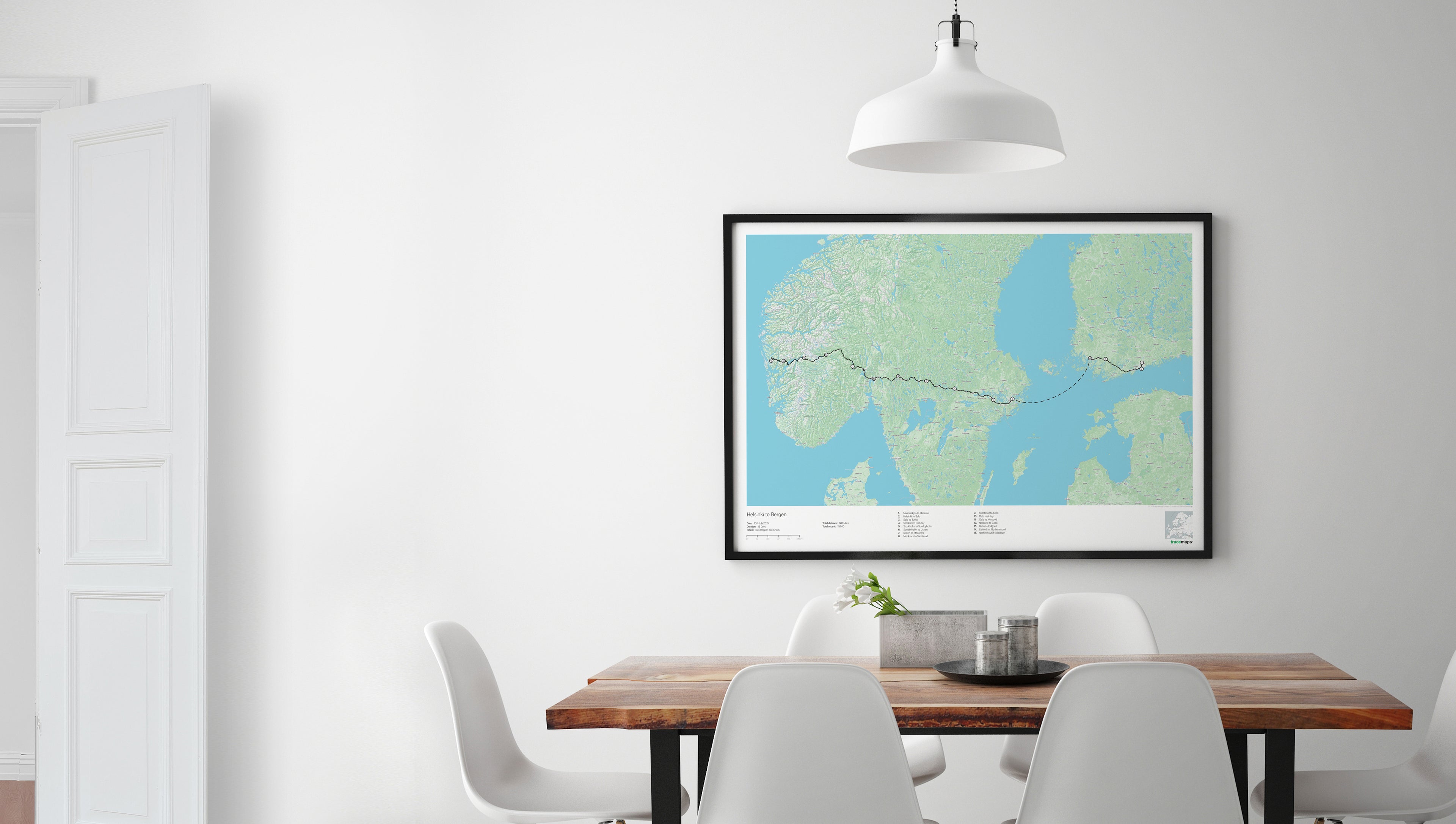
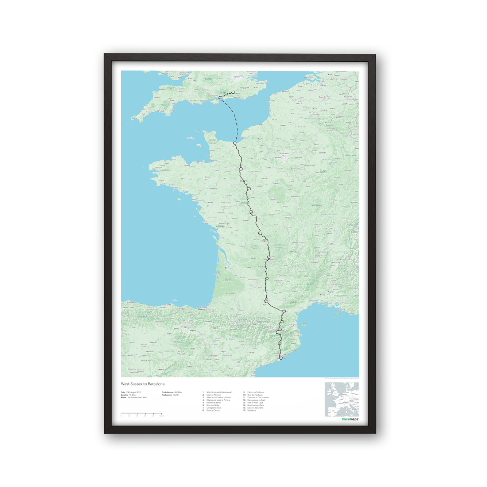
At tracemaps we make bespoke printed maps of your adventures using GPS data to show the exact route.
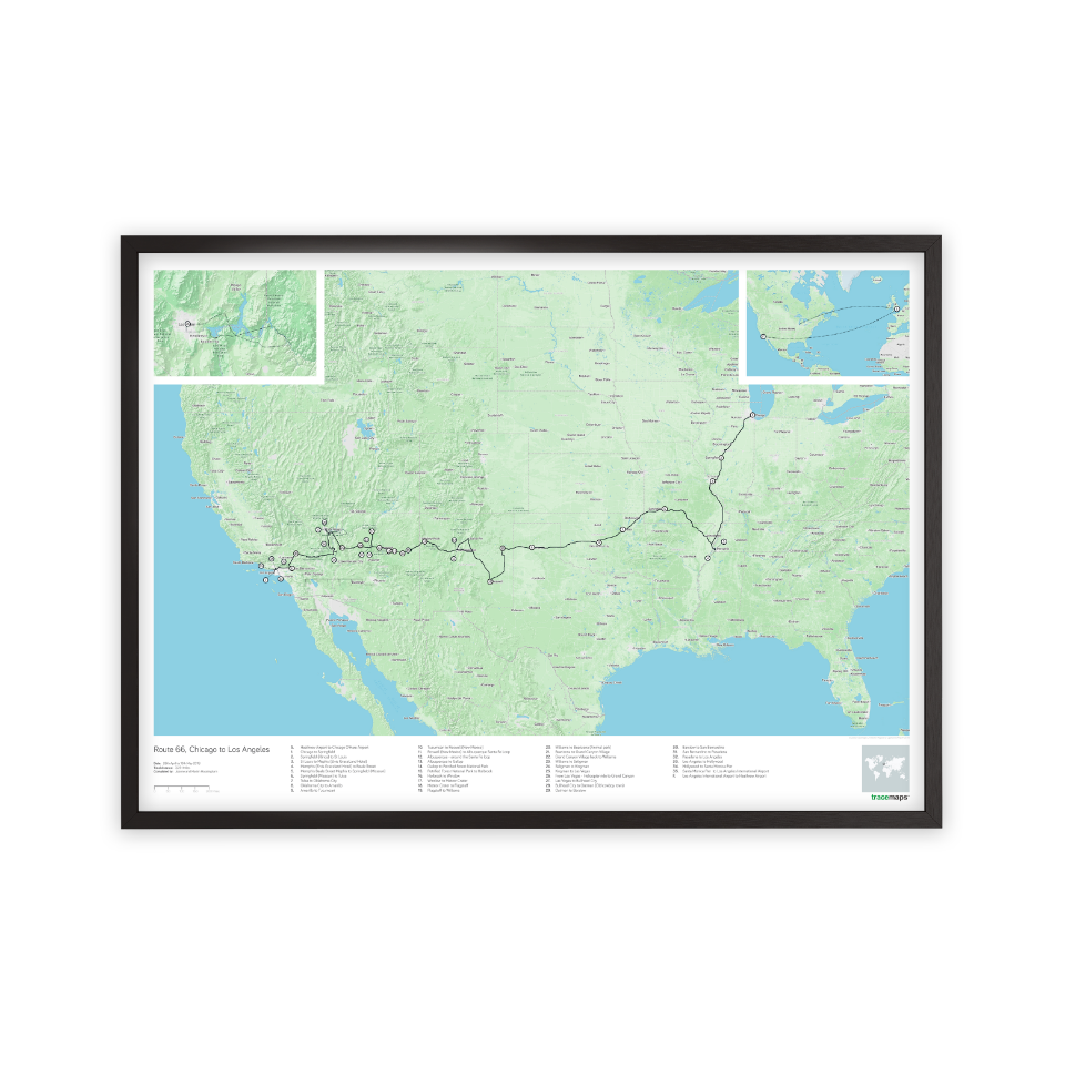
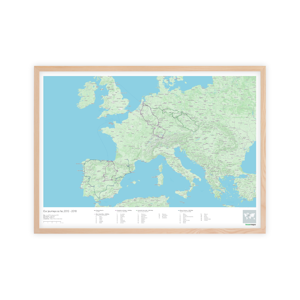
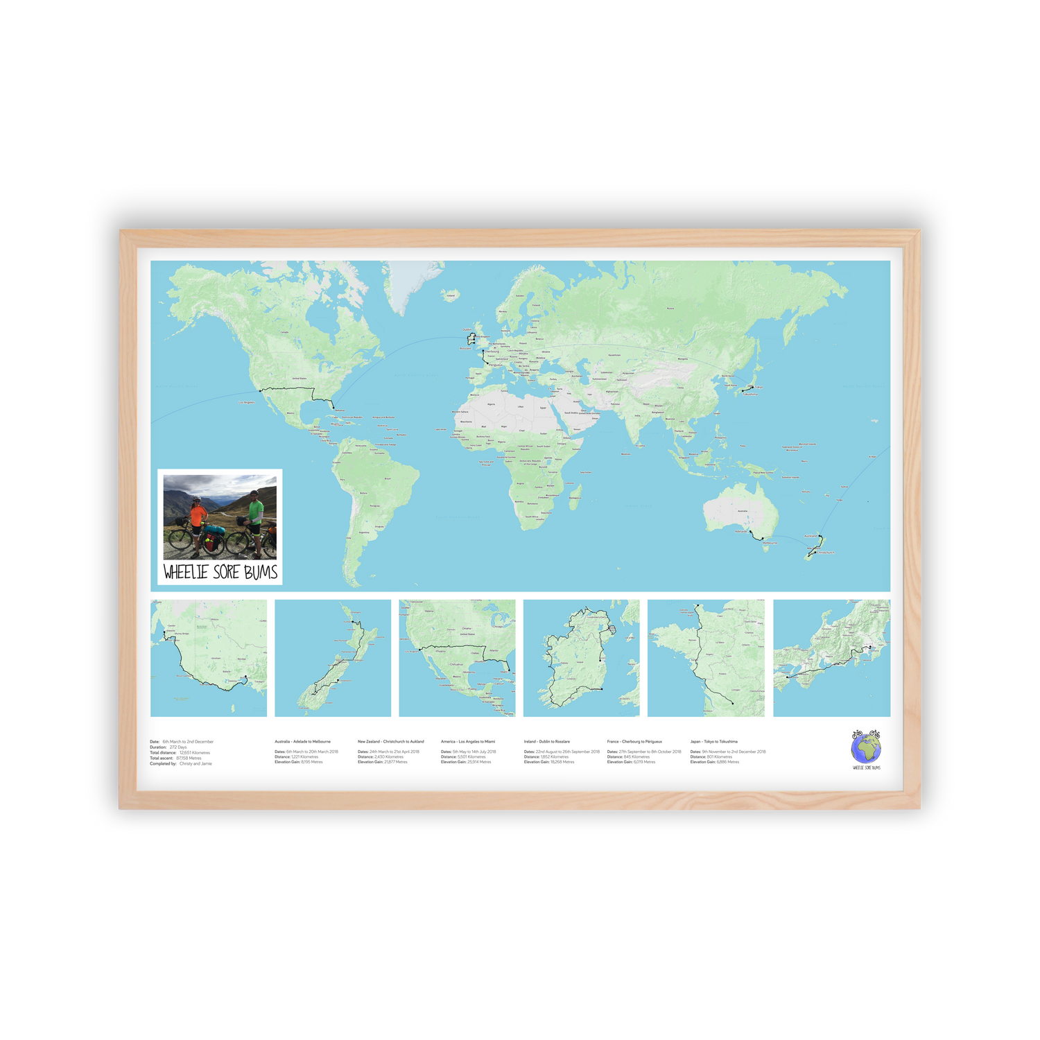
From 5K PBs and Trail Ultra Marathons to Country Crossing Cycle and Motorcycle Tours we create unique mementos of your achievements to tell the story.
It’s not just about the destination, but the journey along the way!

Printed on archival quality paper with fine art inks
High Quality framing available
UK Postage and packaging included
How it works
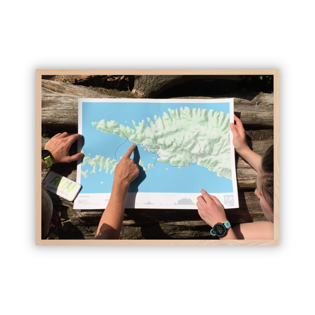
Record your adventure on a GPS device.

Then choose which way you would like to create your map below.

We then draw your map and send you a preview to review before we print.
No data? No problem.
Key features
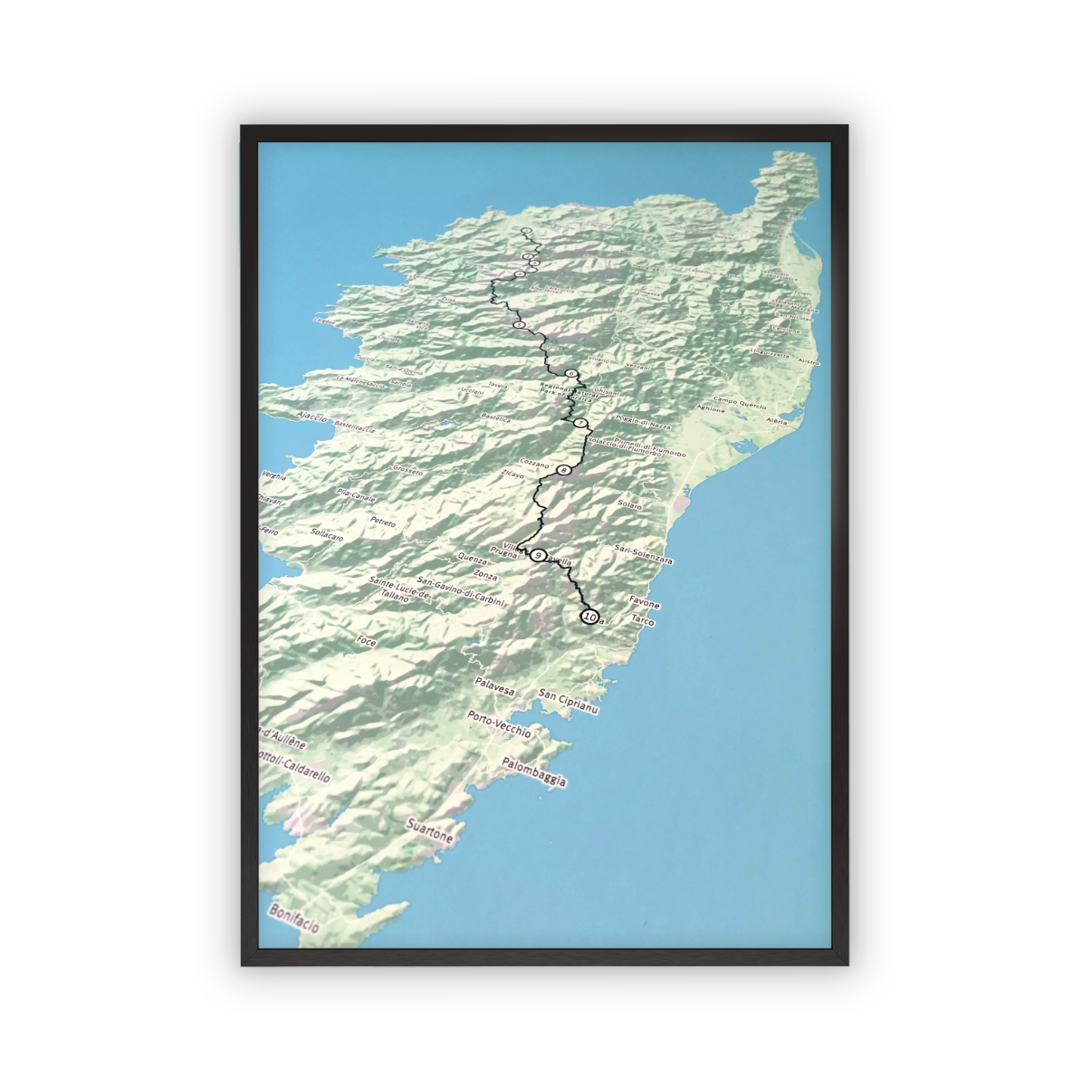
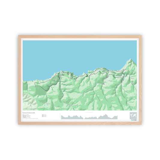
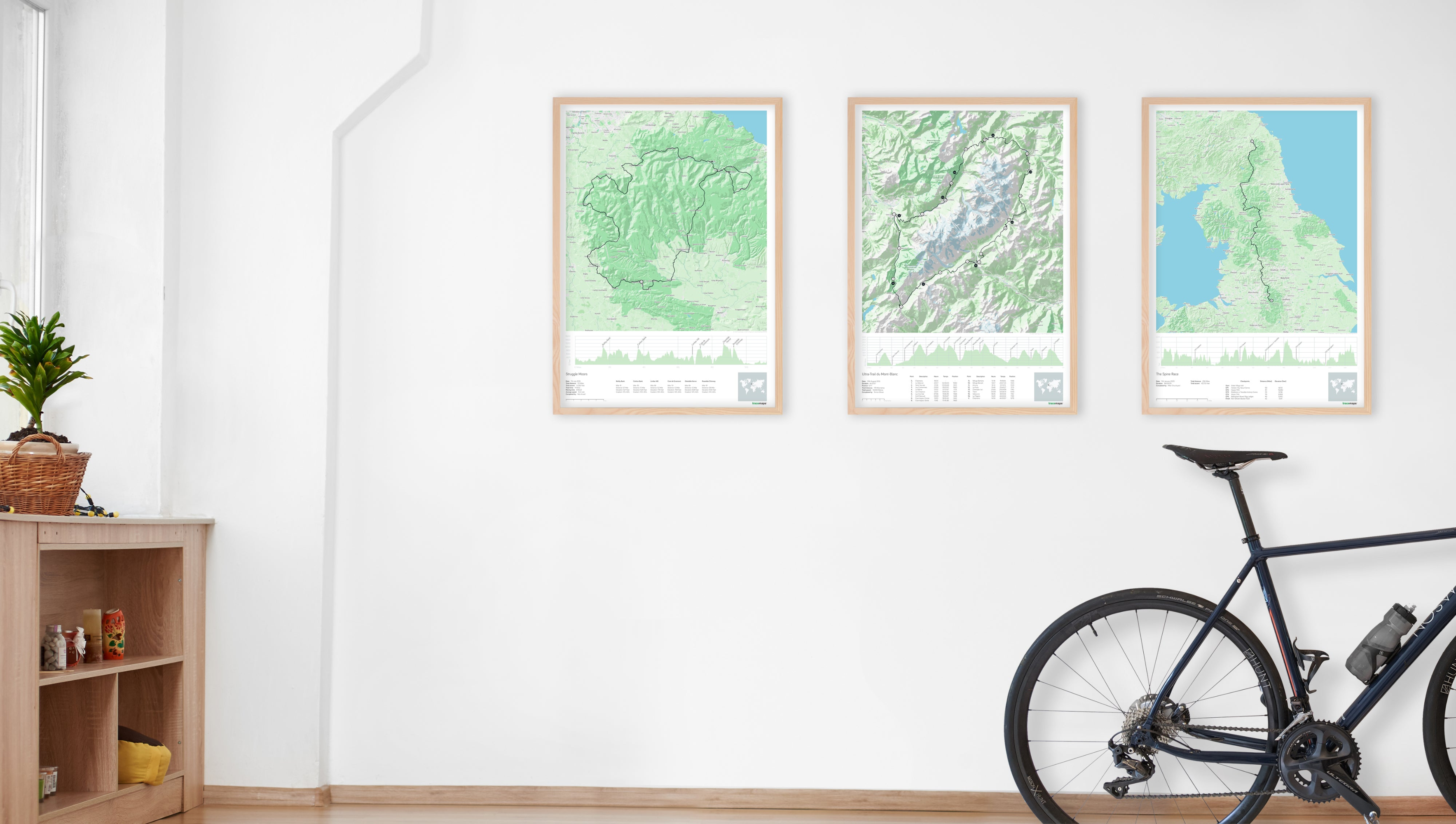
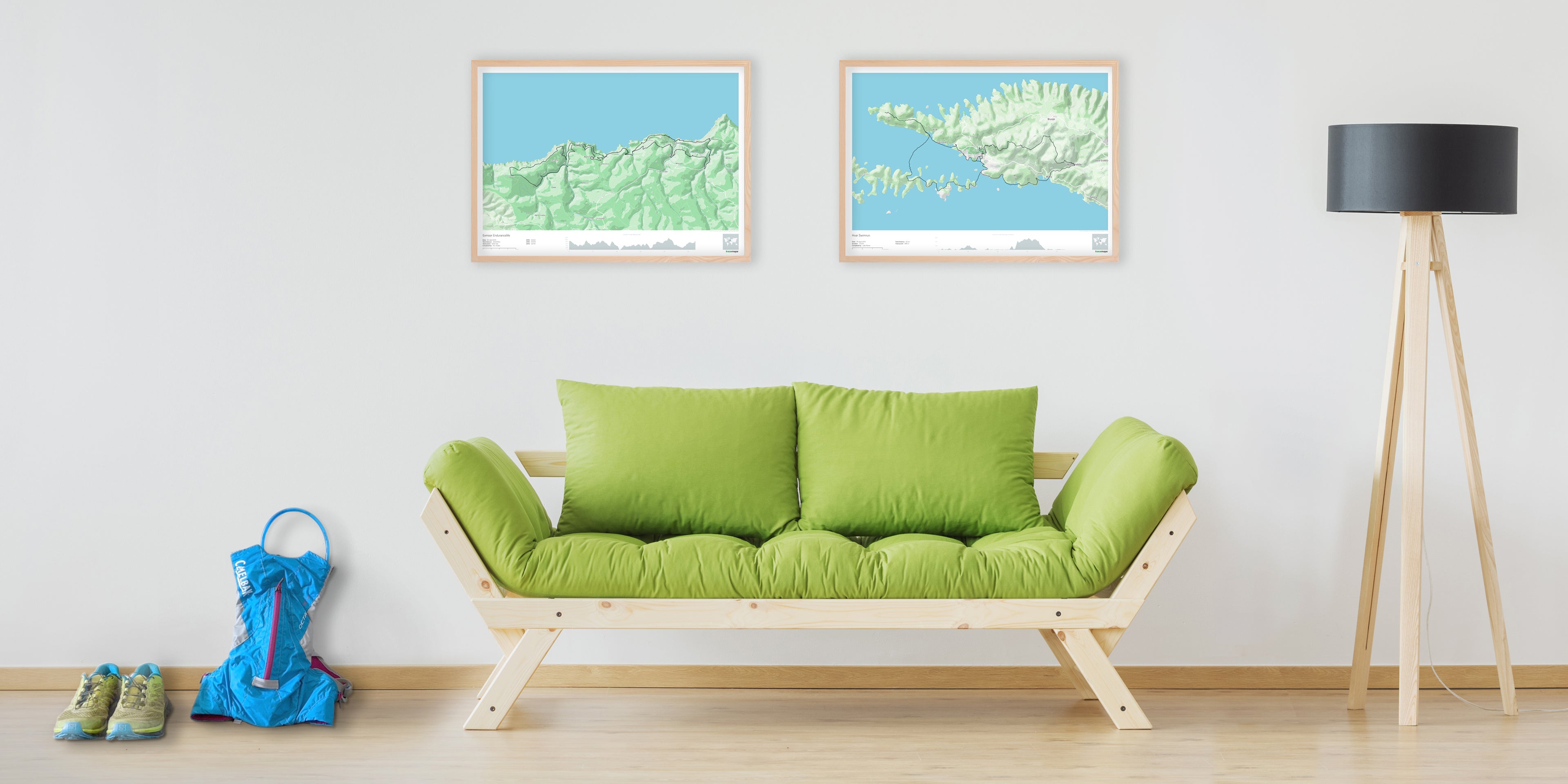
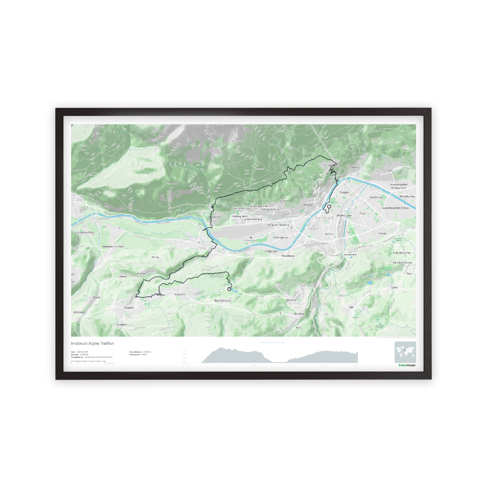
Beautiful relief shading.
The main image captures the formation of the land and the challenge of crossing it.
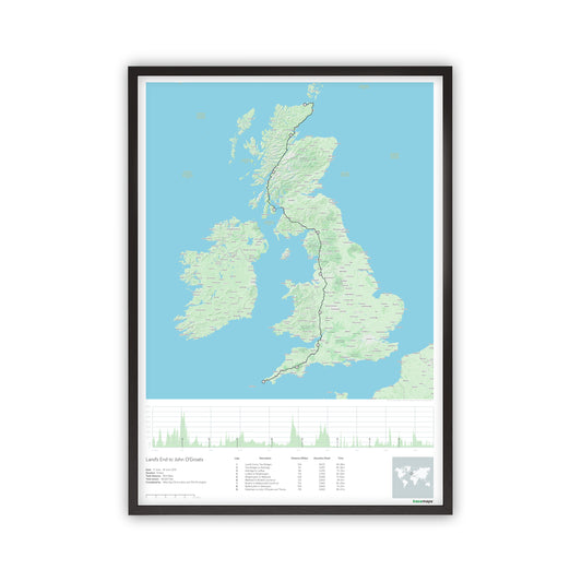
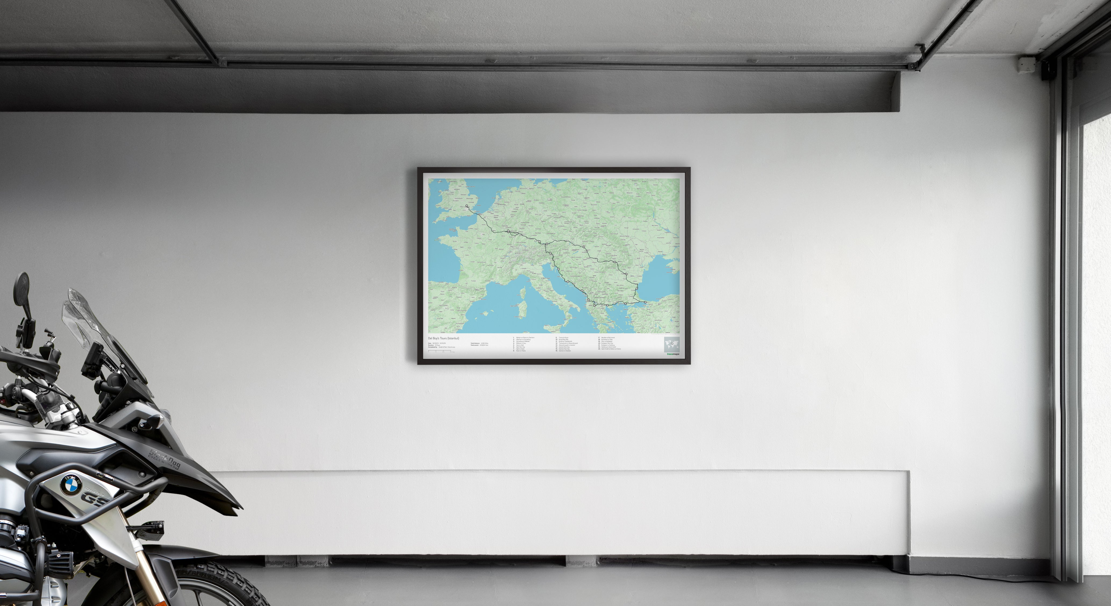
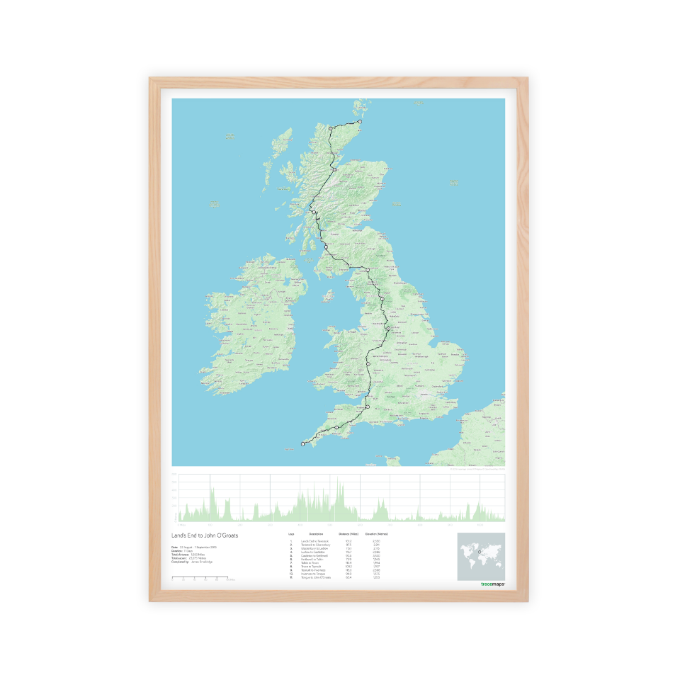
Map anywhere in the world.
We can map any scale of trip in any location on the globe. From a 5k personal best to a round-the-world adventure.
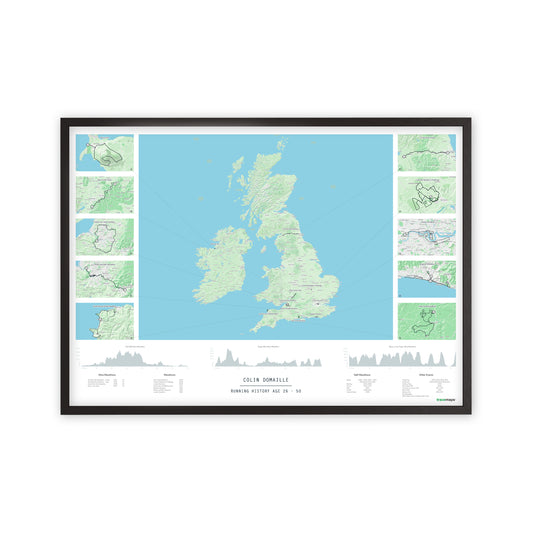
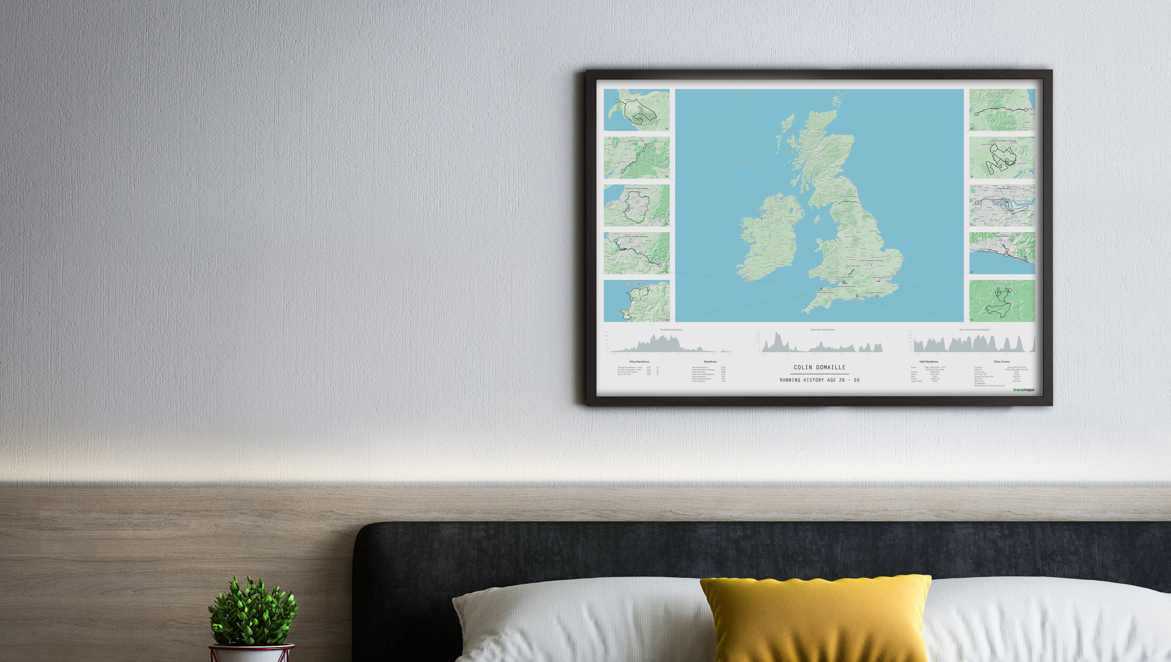
Magnify the details.
We use distinctive cutaways to zoom in on the details of your trip so no elements are missed from the story.
An Accurate and authentic look.
We have developed an authentic map style that conveys real world adventures. Based on Open Street Map data it is accurate too.
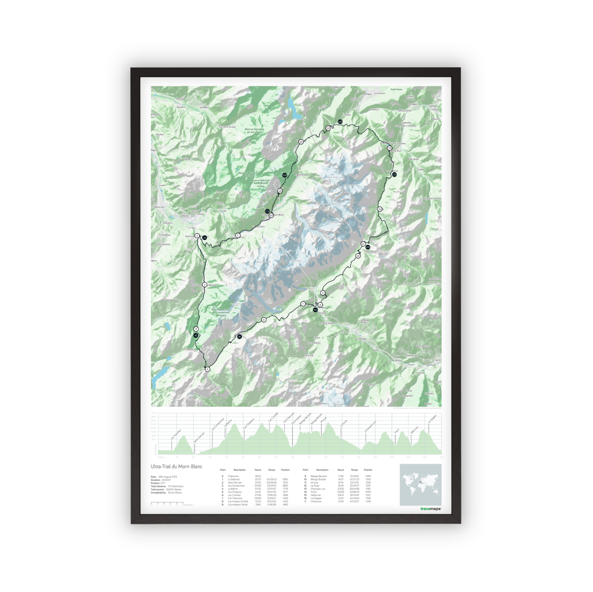
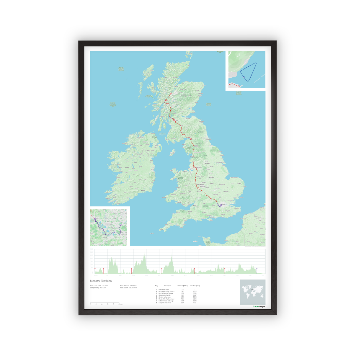
Fascinating elevation profiles.
Our maps can depict all the climbs and descents of your journey. Giving you one complete cross section of your route.
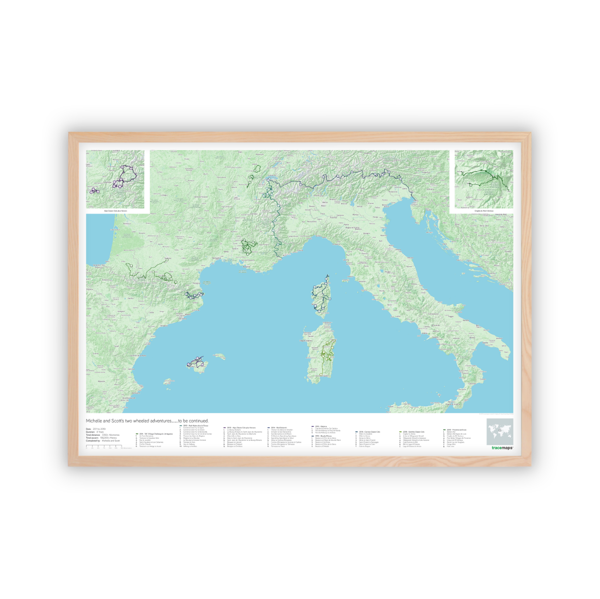
Bespoke legends, statistics & layouts.
Our maps are adaptable by design to capture the unique characteristics of your journey.
Our products
-
Single Day tracemap
Regular price From £50.00Regular priceUnit price per -
Multi Day tracemap
Regular price From £50.00Regular priceUnit price per -
Multi Trip tracemap
Regular price From £100.00Regular priceUnit price per